![](/images/other/stat-length.png)
![Trail Mountain bike Le Bourget-du-Lac - Chartreuse - Col du Crucifix - Photo](https://media.geolcdn.com/t/1900/400/ext.pjpeg?maxdim=2&url=https%3A%2F%2Fservices.sitytrail.com%2FGeolivesWS%2FDownloadMedia.ashx%3FTrailID%3D102126%26Media%3D2516_1.jpg)
Chartreuse - Col du Crucifix
tracegps
User
![Length](/images/other/stat-length.png)
![Max alt](https://static1.geolcdn.com/siteimages/upload/files/1508320355ic_sort_altitude_max_24dp.png)
![Uphill gradient](https://static1.geolcdn.com/siteimages/upload/files/1508320355ic_sort_den_pos_24dp.png)
![Km-Effort](/images/other/stat-length.png)
![Min alt](https://static1.geolcdn.com/siteimages/upload/files/1508320355ic_sort_altitude_min_24dp.png)
![Downhill gradient](https://static1.geolcdn.com/siteimages/upload/files/1508320355ic_sort_den_neg_24dp.png)
![Boucle](https://static1.geolcdn.com/siteimages/upload/files/16400158638029165_repeat_loop_refresh_sync_direction_icon.png)
![Mountain bike](https://static1.geolcdn.com/sitytour/trail-icons/202.png)
4h00
Difficulty : Difficult
![Scan this QR Code to open this trail in the SityTrail application](https://capi.geolives.com/qq0zvz2zws4bq2lad0pu/sitytour/trails/102126/qr.png?size=200)
FREE GPS app for hiking
About
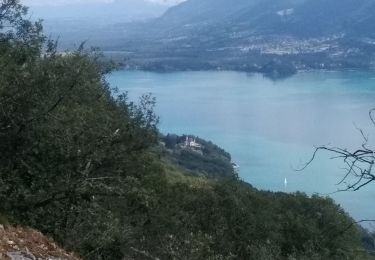
Trail Mountain bike of 27 km to be discovered at Auvergne-Rhône-Alpes, Savoy, Le Bourget-du-Lac. This trail is proposed by tracegps.
Description
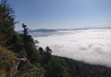
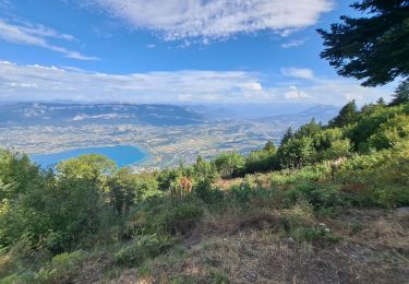
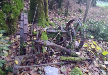
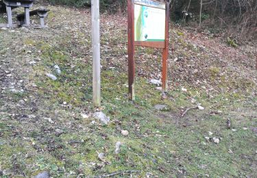
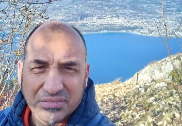
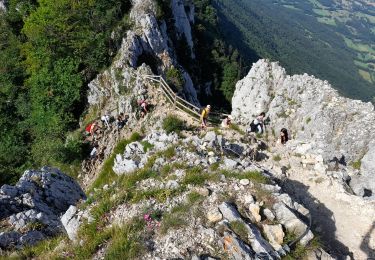
Circuit proposé par Alpes Tour « Au départ de la Roche St Alban entre le Bourget du lac et la Motte Servolex, le parcours s'engage sur une piste forestière sans grande difficulté. La première halte se fait au col de l'Epine après les deux derniers kilomètres effectués sur la route goudronnée…» La suite et toutes les infos, les photos sont ICI Attention à la descente du col du Crucifix par temps humide !!
Positioning
Comments
Trails nearby
![Trail Walking Le Bourget-du-Lac - La Dent du Chat 1390m, le Molard Noir 1452m - Photo](https://media.geolcdn.com/t/375/260/ext.jpg?maxdim=2&url=https%3A%2F%2Fservices.sitytrail.com%2FGeolivesWS%2FDownloadMedia.ashx%3FTrailID%3D102504%26Media%3D3313_1.jpg)
![Walking Walking](https://static1.geolcdn.com/sitytour/trail-icons/101.png)
Walking
![](/images/other/stat-length.png)
![](https://static1.geolcdn.com/siteimages/upload/files/16400158638029165_repeat_loop_refresh_sync_direction_icon.png)
![Trail Trail La Motte-Servolex - Château Richard et croix du Signal - Photo](https://media.geolcdn.com/t/375/260/3752241f-e62c-4bc8-86ee-aa981979bc96.jpg&format=jpg&maxdim=2)
![Trail Trail](https://static1.geolcdn.com/sitytour/trail-icons/104.png)
Trail
![](/images/other/stat-length.png)
![](https://static1.geolcdn.com/siteimages/upload/files/16400158638029165_repeat_loop_refresh_sync_direction_icon.png)
![Trail Walking La Motte-Servolex - 73 Croix du signal via Château Renard - Photo](https://media.geolcdn.com/t/375/260/b1ac2841-4f6c-4818-af5e-d71b85094992.jpg&format=jpg&maxdim=2)
![Walking Walking](https://static1.geolcdn.com/sitytour/trail-icons/101.png)
Walking
![](/images/other/stat-length.png)
![](https://static1.geolcdn.com/siteimages/upload/files/16400158638029165_repeat_loop_refresh_sync_direction_icon.png)
![Trail Walking Le Bourget-du-Lac - Dent du Chat, Mollard Noir, Refuge du Relais du Chat au départ du Sentier Botanique - Photo](https://media.geolcdn.com/t/375/260/89fa4c90-58f1-4891-bad5-9bd4924cd4f6.jpg&format=jpg&maxdim=2)
![Walking Walking](https://static1.geolcdn.com/sitytour/trail-icons/101.png)
Walking
![](/images/other/stat-length.png)
![](https://static1.geolcdn.com/siteimages/upload/files/16400158638029165_repeat_loop_refresh_sync_direction_icon.png)
![Trail Walking Nances - ballade vers Nances - Photo](https://media.geolcdn.com/t/375/260/08823fc1-7084-40fb-98e3-3a7cfdd25397.jpg&format=jpg&maxdim=2)
![Walking Walking](https://static1.geolcdn.com/sitytour/trail-icons/101.png)
Walking
![](/images/other/stat-length.png)
![](https://static1.geolcdn.com/siteimages/upload/files/16400158638029165_repeat_loop_refresh_sync_direction_icon.png)
![Trail Walking Le Bourget-du-Lac - mixte Pierre Nioule/croix du signal - Photo](https://media.geolcdn.com/t/375/260/c4b92019-89a6-4bfe-818d-fe93f3447b41.jpg&format=jpg&maxdim=2)
![Walking Walking](https://static1.geolcdn.com/sitytour/trail-icons/101.png)
Walking
![](/images/other/stat-length.png)
![](https://static1.geolcdn.com/siteimages/upload/files/16400158638029165_repeat_loop_refresh_sync_direction_icon.png)
![Trail Walking Le Bourget-du-Lac - Le Molard du mont du Chat - Photo](https://media.geolcdn.com/t/375/260/ec8abf10-1e1d-496d-bf4f-ea01891581c4.jpg&format=jpg&maxdim=2)
![Walking Walking](https://static1.geolcdn.com/sitytour/trail-icons/101.png)
Walking
![](/images/other/stat-length.png)
![](https://static1.geolcdn.com/siteimages/upload/files/16400158638029165_repeat_loop_refresh_sync_direction_icon.png)
![Trail Walking Le Bourget-du-Lac - DENT DU CHAT - MOLARD NOIR - Photo](https://media.geolcdn.com/t/375/260/76401a4e-6573-4620-b965-ea78100847f0.jpg&format=jpg&maxdim=2)
![Walking Walking](https://static1.geolcdn.com/sitytour/trail-icons/101.png)
Walking
![](/images/other/stat-length.png)
![](https://static1.geolcdn.com/siteimages/upload/files/16400158638029165_repeat_loop_refresh_sync_direction_icon.png)
![Trail Road bike Le Bourget-du-Lac - Tour du lac du Bourget par ontex - Photo](https://media.geolcdn.com/t/375/260/ff88a69a-20e5-4782-ac8d-3a72ff431962.jpg&format=jpg&maxdim=2)
![Road bike Road bike](https://static1.geolcdn.com/sitytour/trail-icons/201.png)
Road bike
![](/images/other/stat-length.png)
![](https://static1.geolcdn.com/siteimages/upload/files/16400158638029165_repeat_loop_refresh_sync_direction_icon.png)
Superbe! Mais par temps de pluie ou d'humidité, gaffe!